Exploring Utahs Green River canyon
By Brian Schulz

Grinding down the pitted gravel road, our shuttle van kicked up a plume of red dust that enveloped the trailer where our kayaks hung from straps. Squinting through the window I looked out over crumbling ochre hills, grasping for the distance and size of pinnacles and mesas. If it weren't for the sagebrush clinging to the roadside in sparse patches, I wouldn't believe that life could survive in a place like this. Scorching summer temperatures, almost no topsoil, and minimal rainfall make the southern Utah desert a less than optimal environment for living things. According the colorful kiosks I'd read at the Canyonlands National Park headquarters, this place wasn't always a raspy wasteland. With difficulty I tried to imagine a vast shallow ocean teeming with life, or a swamp filled with giant ferns and dinosaurs. A lot can change in three hundred million years. For millennia life flourished here, until the dinosaurs were replaced by a vast sand dune desert. With time the dunes became a thick blanket of sandstone, until volcanic activity forced the landscape skyward allowing surface water to drain more readily. Trickling water slowly carved it's way downward through sandstone, shale, and limestone, exposing the remains of ancient deserts, swamps, and seas.
Twelve million years later the result is one of themost dramatic desert landscapes on earth. Literally thousands of slot canyons have been carved across region, the largest being the deep canyons of the Colorado and Green rivers. The Green flows seven hundred thirty miles from Wyoming's' Wind River Mountains to the confluence with the Colorado River in southeast Utah. Near the end of it's journey the Green flows for a nearly a hundred miles through steep and often sheer walled canyons, into the precipitous and often surreal wonderland of Canyonlands National Park.
The popular paddling section of the Green River flows 97 river miles between Ruby Ranch and the confluence with the Colorado, one hundred miles south of the town of Moab. Ensconced in BLM land and later entering Canyonlands National Park the Green carves it's way into ever deepening canyons, wandering through streaked sandstone cliffs and slopes of crumbling shale; a trip on the Green River is a journey in visible geologic time. Since I first turned the pages of Edward Abbey's classic Desert Solitaire, I'd dreamed of canyon country. I imagined wandering across slickrock mesas and into box canyons in search of hidden cottonwood groves, listening for secrets on the still whispers of the desert wind. That was before a climbing fall tore the ligaments from my SI joint, before I found my place in the seat of a kayak. I still dreamed of canyon country though, and when I found out I could float through it in a kayak, I booked a shuttle.
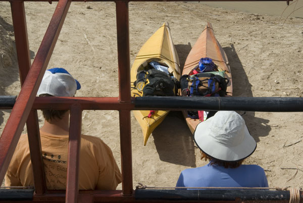
If you were ambitious you might find your way to the put in on the Green, but there is only one way out, a jet boat shuttle up the Colorado River to the town of Moab. Pat and I chose Tex's Riverways on the recommendation of friend. At the desk I signed waivers and releases and a grizzly fellow named Devon looked hard into my eyes. "Are you sure you are ready to be the trip leader on this journey and to assume all the awesome responsibilities that entails?". "Well," I asked, "are there any hazards on the river I need to be aware of?" He laughed, "At mile sixty five there is a rock on river right that if you were extremely, extremely drunk, you could possibly crash into and capsize." "I think I can handle that." I answered, and signed my name. Tex's doesn't advertise, instead relying on word of mouth to build their reputation.
Our van rattled to a stop and we untied our lightweight skin-on-frame kayaks and stuffed them full of camping gear, fresh food, and six gallons of fresh water apiece. Suddenly our kayaks were not so lightweight as we slid them down a dusty slope to the water's edge. Thatcher, our shuttle pilot, offered information on the rivers biology, geology, and native ruins. While I unloaded and packed the kayaks he carefully paged through the river guide with Pat, marking out ruins, features, camping spots, and water sources. Pat and I climbed into our cockpits and slipped quietly off the muddy bank and into swiftly flowing brown water, the river perhaps seventy feet wide and flanked by low crumbling muddy slopes dotted with sage and other scrub. Drifting in lazy circles I lay on the back deck with my eyes closed while Pat added a thick patina of sunscreen to her already pale complexion. "Ready?" Pat asked, "Not really." I replied, thinking to myself that I might be fine just to here and drift. I sat up and slid my thin Greenland paddle blade deep in the water and pushed. Pat followed, and within a few strokes her longer reach and strong arms pulled a boat length ahead of me. She glanced backed with a mischievous smile, bright blue eyes glinting and a shock of red hair erupting from her scalp. A chemical engineer from Yonkers, New York, Pat is also a kayak racer and she dusts me every time we paddle together, which wouldn't be so embarrassing if she weren't also twenty years older than me. We stroked silently through the desert, seventy degrees and a light breeze, thrilled to be in a T-shirts instead of a drysuits.
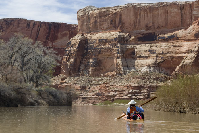
Gliding downriver, we sunk into the surrounding desert sandstone walls. Tan sandstone cliffs rose vertically from the water on either side, first fifty feet high, then a hundred, then a hundred and fifty. I paddled over and brushed my hands across the coarse rounded walls. I've been a canyon junkie my whole life, drawn magnetically to anywhere the topographic lines converged, with a special penchant for anywhere cliffs rise directly from the water. Seven miles later we rounded a corner to Trin-Alcove bend, a massive gap broken in the three hundred foot high sandstone cliffs, offset by a stout grove of old cottonwood on the other side of the river. The opening of a sheer walled side canyon split into three separate alcoves, each dead-ended in a vertical walls of stone. A mile later a new layer of rock emerged, solidified prehistoric mud that formed steep crumbling slopes, above which the sandstone cliffs towered. Soaking up the sun we dipped and pushed our paddles past a huge vaulting arch in the cliffs to our right. A trifle in the scope of geologic time, that arch had probably stood there since before humans walked the earth. We were guests in an immense and ancient cathedral. We paddled onward, winding sinuously through the ever-deepening canyon, the sunlit sandstone bathing us in warm afternoon highlights of red and gold. At twenty-five miles we landed our kayaks at the mouth of Keg Spring Canyon.
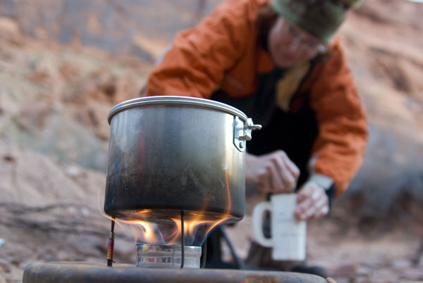
At dusk I poured Everclear into a shot glass and upended it into the primer cup of the cleverest of do-it-yourself camp stoves. The Penny Alcohol Stove is constructed from aluminum cans, will burn any type of high-grade alcohol, and weighs a diminutive 4oz. It cooks cooler and burns a bit more fuel than gas stoves, although it's safer, and a lot more fun. I brushed the primer cup with butane lighter and in less than a minute six silent jets of flame leapt from the burner. This concluded my responsibilities for the day and I was happy to let Pat practice her craft. She produced a small cutting board and I followed instructions, chopping carrots, cabbage, and cucumbers. It wasn't hard to convince Pat to cook for our trip, after she learned that I subsisted primarily on energy bars and cold cereal. She handed me a mixed vegetable salad and a steaming bowl of Ramen noodles, with peas, carrots, tofu and egg, a welcome step up from Cliff bars and corn flakes. We toasted the evening with a glass of chardonnay for her and a shot of scotch for me. At sunset, we hiked up the small sandy wash and found a bedrock slot that contained a small clear pool of water, with overhanging walls of striated bluish shale.
In the crisp chill of morning and I crawled out of bed just long enough to light the stove for tea. We spent an embarrassing two hours packing the kayaks which bulged with unsightly deck loads, something I'd never allow on the ocean. Late morning found us stroking lazily downriver again, gaping at the scenery.
Mid-day we ate lunch on the outside of bowknot bend, a natural oxbow where the river loops eight miles, separated from itself by a narrow stone ridge. High crumbling slopes capped by sandstone looked down on us. At water level the banks were choked with invasive salt-tolerant Tamarisk trees. The Tamarisk grew about ten feet tall and forms an impenetrable thicket between the high water mark and the native grasses and cottonwoods farther inland. This limited our potential landing spots to the occasional sand bar or side canyon.
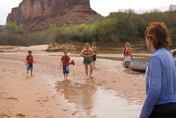
Late afternoon we spotted a small sand bar, seventy-five feet wide and one hundred feet long. We'd paddled twenty miles already, so we decided to stop. While we pulled an assortment of dry bags from the cockpit I glanced upriver and spotted two canoes drifting around the bend upstream. The canoes were fastened together to make a sort of catamaran. As they closed on us I could make out a family with five young children. They paddled straight toward our tiny sand bar, and then crash-landed at my feet. While he amphibious 'minivan' disgorged five shrieking children, I stalked over to the invaders and exchanged words with the captain whose tone asserted that no force short of a flash flood would unseat them from this sand bar. Pat stood beside me, fixing the intruders with a thundercloud glare. As she verged on unleashing a tirade in only the way a New Yorker can, I cut her short, "We can't win this one Pat, we've been usurped." Grudgingly we conceded defeat and slinked back to the river. As we searched downriver for a new campsite the canyon walls soared overhead and rewarded us with the soft reds and tans that only occur in the last hour before nightfall.
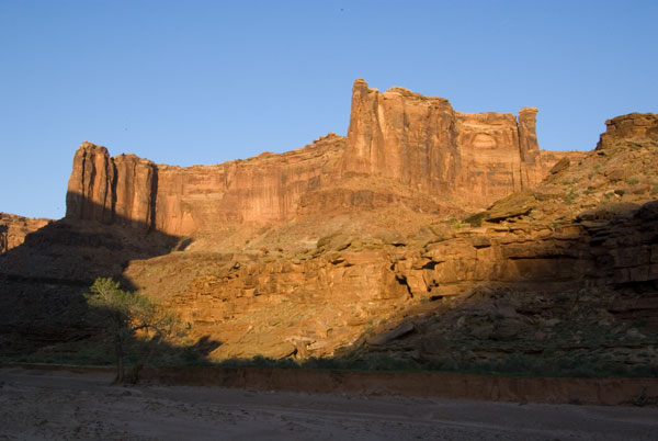
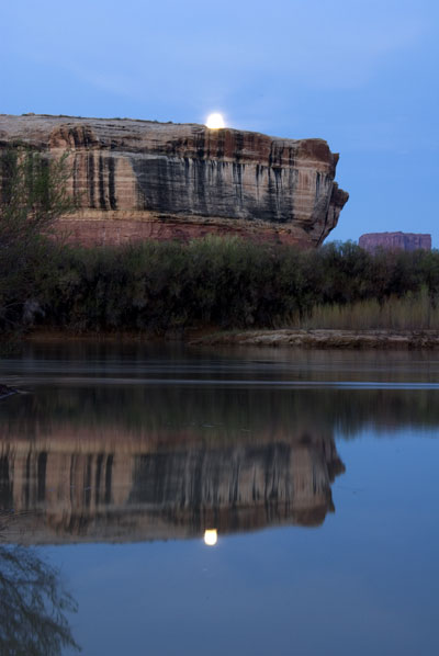
A half hour and three miles later we arrived at Hell Roaring canyon, a large rocky wash guarded by a red rock outcrop the size of a school bus. The notable feature of this campsite was the fractured red rock walls that hemmed in the fifteen foot wide sandy floor. The broken rock walls created many flat stone nooks and shelves and Pat was excited when I introduced her to her new kitchen. She set about the chopping and mixing and simmering while I snapped a few photos of the evening light playing off the high canyon walls. I savored that warm red light until it faded from the sky entirely and was replaced by the rising full moon. I searched for the perfect natural ledge, and once found, planted myself as Pat produced dessert, candied ginger, white and dark chocolate.
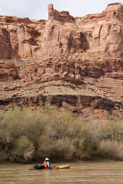
On the third day we passed from the upper river, known as Labyrinth canyon, to the lower, called Stillwater canyon. We entered a wide basin overshadowed by thousand foot tall spires and buttresses, perched above and beyond the rim of the canyon. These crumbling red cliffs and spires are the last remains of a vast plain, now washed away leaving the cores of harder rock still standing. The red spike of Candlestick rock, one of the most prominent, remained visible for nearly two days on the river. At a wide bend in the river called Fort Bottom, we baked in the sun while we ate lunch on a red table rock.
Our water supplies were dwindling, so now our attention turned toward finding a spring that out shuttle driver had marked as 'obvious' on our map. Ultimately it was more of a hunch that led us to land next to some canoes tied to a steep brushy bank. We scrambled up a muddy slope where we found a campsite and a seven-year-old boy named Adam, who was on his third trip down the Green with his grandparents. Adam said he could show us where the spring was and we followed him across a half mile wide cactus studded field to a slippery cliff where we scrambled forty near vertical feet up a treacherous crumbling slope to find a pool a small cave where water trickled out from the cliff. We thanked Adam and made a not so graceful exit, desperately clinging to the overhanging tamarisk while our legs windmilled and our feet greased their way back down to kayaks.
Further in Stillwater canyon a band of vertical white sandstone rose again from the waters edge, streaks of hardened 'desert varnish' drooled down the walls, these shiny mineral deposits gave the appearance that someone has upended a giant vat of brown paint at the canyon rim. Late in the day our toll was twenty-nine river miles. We'd pushed to far past too many good campsites in search of the perfect campsite. Instead I'd landed us in Holeman canyon, a small dusty wash in the shadow of a large overhanging swell of White Rim sandstone. I was less than crazy about the dust, over the years I've come to despise sand and dust for it's uncanny ability to insinuate itself into every possible corner of ones gear, and in this case, washing it off wasn't even an option. The dust is suspended in the river itself, and any form of washing means exchanging visible particles of dirt for and invisible layer of clay. The first night we'd tried to bathe in the river and the salty silt dried us into a raspy, scaled, lizard people. Luckily Pat had thought to bring lotion and we were already rationing it.
That night we enjoyed a small fire in the required fire pan we'd carried with us. While searching for driftwood we debated whether or not a small half buried piece of wood in the middle of the wash could possibly be attached to a living root. I imagined the conversation with a park ranger, "Well, we used the fire pan... but we cut down a live tree." Pat laughed so hard that tea spewed from her nose!
The mud here comes in two varieties: the sticky kind that lines the upper river but can be washed off with a bit of a shake in the water, and the really sticky kind on the lower river that has swallowed the shoes off many unsuspecting paddlers. Prior to this landing I'd imagined that mud was only useful for exfoliating masks and nude wrestling, but afterwards I became convinced I could market it as a secret military adhesive. We responded to the brown glue with a new launching technique. Entering the kayaks our feet were covered with gobs of the stuff, so we sat butt-in-the-saddle, legs draped over the sides, and paddled to the middle of the river. Then we'd unite and wash each others feet until free of the stuff, drifting in slow lazy circles, engaged in this strange preening ritual.
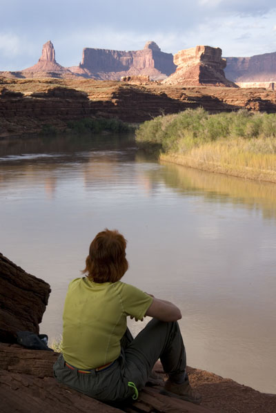
The lower river is a more popular paddling section and the day before we'd encountered several groups of canoeists so on our fourth day we woke early in hopes of getting a better campsite. Our progress for the last three days had put us well ahead of our intended position and we were running out of canyon to explore so we limited our paddling to eight miles. As the Canyon cut deeper the White Rim sandstone again climbed onto crumbling red slopes capping them with vertical, smooth, two hundred foot high barrier that formed the rim of the canyon.
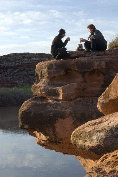
Late that morning we landed at a Dead Horse Canyon, a forked twelve-mile deep wash overlooked by a giant crumbling sphinx called Turks Head and fronted by a sandstone ledge that overhung the river. Before we could tie up the kayaks I was already excitedly scrambling across the wash with the lunch bag. "C'mon Pat!" I shouted, "We gotta eat lunch on that ledge!" Dragging Pat behind me, I climbed a short sandy trail and set up lunch as close as possible to the edge. We faced north toward the Turks Head and ate lunch with our feet dangling over the river. A hundred foot tall sandstone cliff carved an alcove behind us that contained a small grassy field and a couple of big boulders that looked to me like the carefully placed rocks in a Zen garden. "Pat," I beamed, "this is the spot." I was referring to that special moment when ones surroundings perfectly match ones ideal expectations. I'd been on a lot of trips where I never found the spot. We set up camp in a flat hard packed clay nook, with small overhanging cottonwood trees for shade, a wild rose bush, and even a bit of grass. We napped in the tent through the heat of the day and occupied the afternoon withan extensive foray into the many side arms of Dead Horse Canyon in search of Anasazi ruins and petroglyphs. Instead we found a bighorn sheep skeleton lying on the sandy floor. It felt like a scene from an old west movie and I half-expected a tarantula to crawl past, a tumbleweed to blow by, and a rattlesnake to sound in the distance.

Sad to be leaving this place, we perched upon the ledge at sunrise for a final cup of tea before making our way down to the boats, one of which was mysteriously overturned in the night. After a hard look at the animal tracks in the mud we concluded, as unlikely as it seemed, that Canada geese had come in the night, and working together they had pushed the kayak upside down. The more I thought about it the stranger it seemed. "Lets get out of here," I whispered, "before they come back."
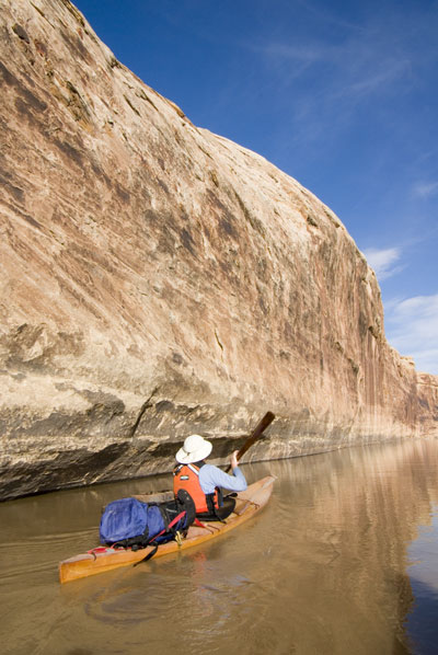
We escaped the lurking birds and sunk our paddles and our eyes deep into the heart of canyon country. The walls overhead loomed an impressive thousand feet of alternating solid and crumbling layers. More monument rocks peered down from the rim. Pat stroked ahead of me, framed by the sandstone walls, sun shone through her skin-on-frame boat. The next few river miles led us into a gorge with striated, red shale walls and numerous dark narrow side canyons. This was a short section and by the time I'd decided it was worth exploring, a new layer of stone appeared, blocking access to the side canyons that were now hanging valleys. That's how it is on the Green, lots of big crumbly slopes punctuated by short sections of sheer canyon, if you see something worth exploring, you should stop and explore it. Pushing forward won't get you anything better, only closer to the end of the trip. I suppose that's a life lesson too, one I have yet to learn.
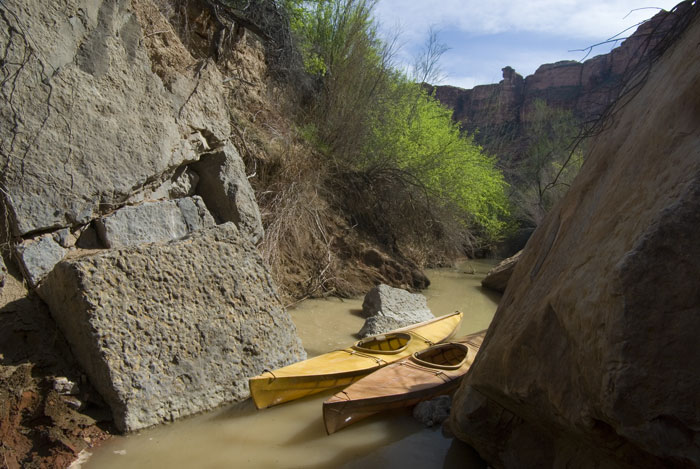
With so few river miles ahead of us we planned another short day, aiming for Jasper canyon ten miles downriver and hoping to finally find some of the elusive cliff dwellings. The canyon here approaches it's deepest point, almost a thousand feet below the White Rim sandstone cap.We were a little disappointed when we paddled up to find the Jasper Canyon campsite occupied, and continuing downriver we looked for any possible landing spot. "What about here?" Pat said as she nosed her kayak down a narrow canal barely wide enough for a kayak and choked with Tamarisk. 'You are going to be so screwed when you get far enough to find out this is a dead end.' I thought to myself as I carefully backed my kayak down the channel. Proving me wrong, Pat persisted, scratching her way forward until the channel ended in a steep rocky slot that prevented the tamarisks from taking hold at the bottom of a gravel wash. Gravel, I liked this place already. We hopped out and explored up the wash coming to three old Juniper trees, big enough for real shade, large rocks to set up the kitchen on, and a flat spot for the tent. While Pat prepared the kitchen I explored up the steep rock fall behind our camp in the late afternoon. Running back down I found Pat, "You gotta see this!" I exclaimed. I led her up the rocks and we wove our way through house-sized boulders. About a hundred feet up we encountered a bluish stone shelf and a trickle. Climbing upward I pulled her onto a second shelf of hard rock, where a cottonwood grew amidst a jumble of large boulders and a small pool of water flowed out of a cave. Where it seeped from the walls, life flourished. A thin layer of vegetation clung to the moist rocks. I closed my eyes and rubbed my face on the wet moss and ferns. It was dusk and a bat flew down in front of us, skimming the pool for a drink of water and leaving ripples in it's wake.
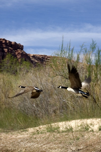
The morning was cold and packing our things we watched a band of sunlight slowly crawl down the opposite canyon wall. Two Canada geese flew down the canyon shattering the silence. Constrained by the canyon walls their honking creating a cacophony of echoes that grew louder when they flew right past us. Packing our kayaks while they floated in the tiny sheer walled slot was a challenge, and getting aboard was a trick that involved too much cold water for so early in the morning, but soon enough we were back in the canyon and headed downriver.
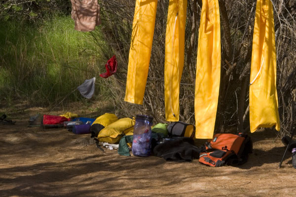
Hailing from the world of 'bring everything but the kitchen sink' kayak camping, I gently eased Pat into the cult of ultra-light. Through correspondence I'd stripped a quarter of her kit, and then another quarter at the motel room. We'd been on the river for five days and she reluctantly admitted to not feeling too deprived. Tomorrow we'd be leaving the river for a two-day hike and now it was time for the final paring of supplies. We set out the backpacks we'd been lugging on our back decks for days and began the careful process of selecting only the essentials; the packs had to weigh less than thirty pounds each. It's true that some maniacs take this sort of thing too far; I'd done it myself and suffered for it, touring with fifteen pounds of gear in a traditional Greenland kayak. Once we'd sorted out the basics, I walked over to Pat's pile and added her extra thick Therm-a-Rest sleeping pad and a bag containing half a liter of Chardonnay. "This is what I call luxury-lite." I explained, and she nodded approvingly. The Chardonnay came at the expense of the rain fly for the tent, but this was the desert, and there were plenty of ledges where we were going.
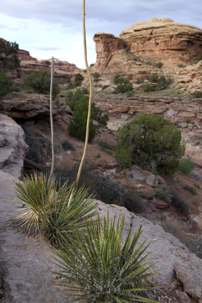
The most remote section of Canyonlands National Park is a 50 square mile natural sandstone labyrinth aptly named The Maze. Hundreds of miles of narrow box canyons wind through the interior, most ending in sheer walls up to four hundred feet high. One hiking guide warned against 'becoming lost forever in the ever deepening canyons.' Access to the Maze is won by long scorching hikes, a 10 hour bone crunching jeep trail, or a hike up from the Green River. Since learning of its' existence, the Maze has captivated my imagination and I chose this river trip, in part, for the access it provided. The following morning we stashed our kayaks at the entrance to Water Canyon one of the only reliably wet side-canyons on this stretch of the river. For a half-mile back from the river bank fifty-foot vertical cliffs hemmed in the canyon floor and valley they created was nearly a solid matt of impenetrable Tamarisk. To access the back of Water canyon we would need to walk carefully along the rim of this canyon inside a canyon, to where the land turns entirely to stone. A trickle of water emerged and disappeared, nourishing sparse cottonwoods growing up through the rocks. Pat and I transferred our gear from sea kayaks to light backpacks, and as we headed up the trail above the tamarisk valley, we left the easy part of this trip behind up.
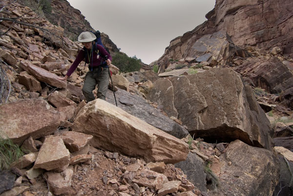
If I thought we would finish this trip without risk to life and limb it was before set eyes upon our 'access' via Water Canyon. A thousand vertical feet of crumbling rock spilled down from the rim of the canyon in less than a third of a mile of horizontal distance. At the back of the canyon we both stared up at a thousand vertical feet of crubling rock capped by the White Rim, and a small opening in the otherwise solid wall of sandstone. "Where's the trail?" Pat inquired. I studied my map and replied, "According to the National Park Service, this IS the trail." It was true, and in fact there were Cairns leading up the slide, placed, almost comically, as though this were any ordinary trail. More than once we wandered off-route while picking our way carefully through the bus sized cubes of rock and sliding slopes, some of which terminated in cliffs below us. After committing my weight to a solid looking boulder I was horrified when it suddenly rolled beneath my feet. I flung myself aside, hoping to land anywhere but in front of the thousand pound cruncher. I looked up at Pat as it rolled to a stop, "That was not cool, way too close." Our final test was a delicate tiptoe along a two-foot wide ledge above a forty-foot drop, the single access point to The Maze from the Green River. Standing on that ledge I looked back at the tiny green river below. We had gained a thousand feet of vertical elevation in less than a quarter mile. Rounding the corner, the scene before me was everything I imagined: twisted and bent walls, sandstone spires and domes, slot canyons peeling off the main wash.
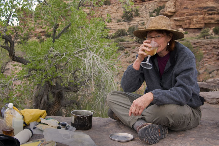
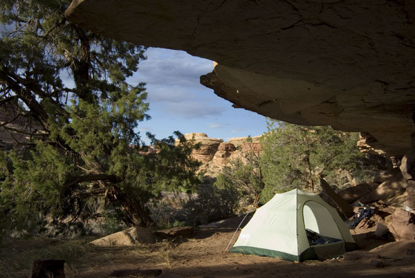
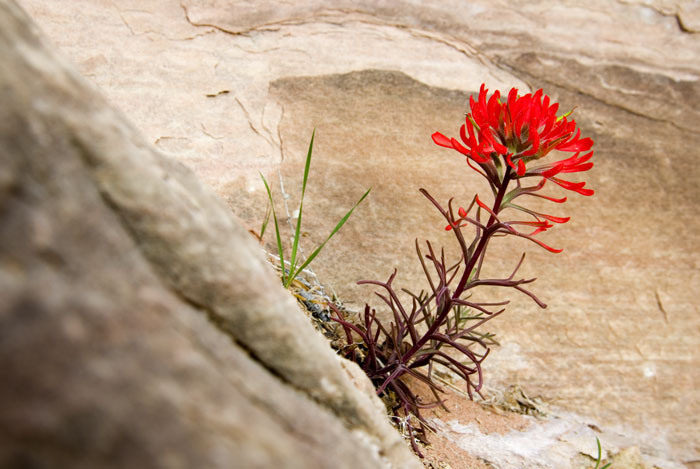
A tiny creek flowed down the center of the canyon floor, meandering across flat bluish stone. We followed the water and another mile brought us to a ledge where the creek fell twenty feet from a faulted ledge forming a waterfall that dropped into a grove of four cottonwoods, thick grasses and a few pools of water. We scrambled up onto the ledge where we found a wide bluish stone shelf with an overhanging lip on one the sandstone walls that formed a roof under which we pitched our tent. I breathed a sigh of relief, the sky had been threatening cloudburst and I'd left out rain fly behind to make room for the rest of our Chardonnay. This campsite exposed us to the danger of flash flooding, but from what I could tell, there wasn't many places in the Maze that wouldn't. We cooked dinner that evening at the edge of the ledge at eye level with the canopy of the cottonwoods that the waterfall nourished. From this base camp Pat and I spent the next two days hiking through slots and over domes, we climbed under arches and up stairways. In one of these narrow slots I found a solitary Indian paintbrush flower growing from a crack in the stone with no other plant for a hundred yards in any direction.
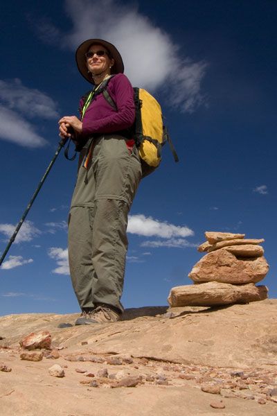
Pat and I are unlikely hikers. Her knees are scarred from multiple reconstructive surgeries, my SI joint is less than properly connected, Pat has asthma and I suffer from an undiagnosed shortness of breath. Nevertheless, we are both competitive and ambitious. The next morning we set out along one of the only marked trails, although trail may be a bit strong of a word. Rather, a line of loose Cairns zigzagged in what seemed like an arbitrary line, following a sandy wash for a while and then veering suddenly up a steep rock slope. The line was not accidental though, someone had spent a long time carefully figuring out the puzzle and steering us away from dead ends which, if followed, could consume precious time and water. I came to understand that standard navigation was useless in The Maze; the challenge is not figuring out where you are, but how to get to where you want to go. For our day hike I packed the most extensive day kit I've ever carried. Fire starters, bivouac gear, food, two gallons of water, full first aid kit, eighty feet of rope, and a roll of duct tape. The National Parks Service made it very clear that we needed to be prepared for self rescue and it's easy to see how a person could disappear forever in this place. We crossed an undulating rock saddle from Water to Shot Canyon and headed toward the center of The Maze.
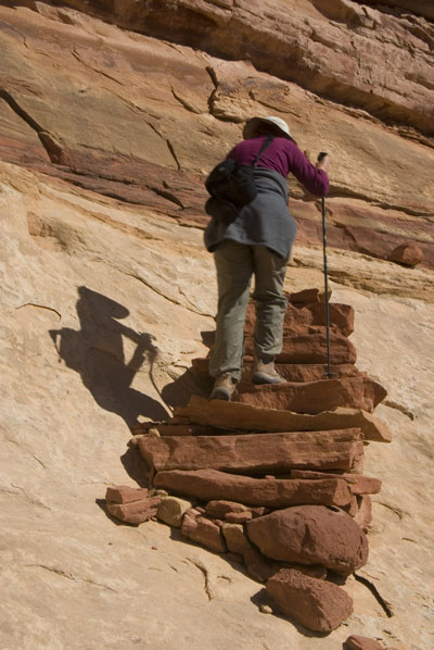
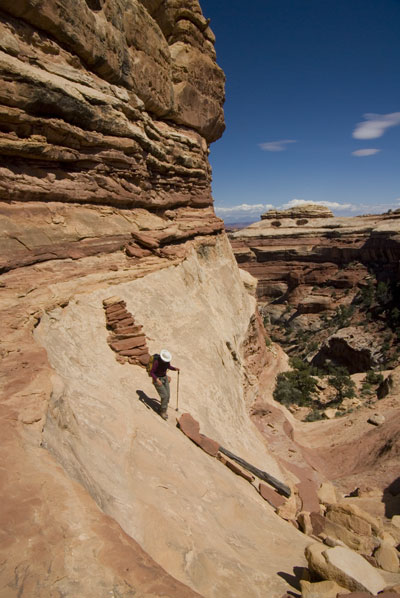
I designated Pat the official 'trail finder' and she clung to the Cairns as not only a waypoint, but as a psychological anchor to combat the fear of being lost. Trekking here is slow and we averaged less than a mile an hour. Making our way towards the back of the canyon we encountered a mini version of yesterdays terror, scrambling up four hundred vertical feet of loose talus before regaining hard slopes again. At the top we crossed into a series of steep scooped bowls leading upwards, where I encountered two unlikely stone staircases. Carefully stacked by an obviously insane trail builder, these stairs clung to the fifty-degree slopes by sole virtue of friction. "You first," I implored Pat with a sideways smile. "I'll stay here and take pictures." Amazingly she passed the stairs without sliding to her demise, so I followed suit and ten minutes later we stood on the rim at the center of The Maze. We gaped at the panorama of serpentine canyons spreading into the distance in all directions. At our feet Shot Canyon dropped off on one side and Jasper Canyon on the other. If I had a religion I'm not sure what it would be but this place would certainly be the temple. Pat unpacked a lunch of rye bread, sun dried tomatoes, oysters, and aged cheese; and we savored each bite with reverence. When most people would be scraping the dregs of oatmeal, here we were eating canapés. Pat stood up, "I want you to take a picture of me so I can send this to my orthopedist."
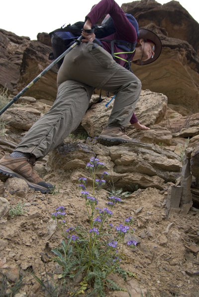
On our last morning in The Maze I awoke to the sound of... "RAIN, wake up Pat, it's raining!" I shook Pat awake. "Wake up, we have to leave NOW. We DON'T want to be here when it FLASH FLOODS." We both sprang from our sleeping bags into motion packing our backpacks. In twenty minutes we went from dead asleep to striding briskly across the already wet floor of The Maze. I pictured what the rockslide might look like with water cascading down it and it added urgency to my steps. It had taken us five hours to get up here; hiking carefully but swiftly the return trip took an intense, focused hour and a half, picking our way down the rocks. We loaded the kayaks under drizzly skies and pressed downriver at an exercise pace, we were both thrilled to be making easy miles after our slow hikes in The Maze. At noon we arrived at the confluence where the Green River meets the Colorado, passing through eddies and small whirlpools as the flows mixed. Riding the currents where scouring rivers intersected, the confluence was our deepest point on the river, nestled twelve hundred feet below the surrounding landscape. The stone here was a crumbling reddish brown, and we paddled by several groups of canoeist waiting for a jet boat shuttle back to Moab. A raft drifted behind us, headed downstream into the maw of the turbulent and thrilling Cataract Canyon section.
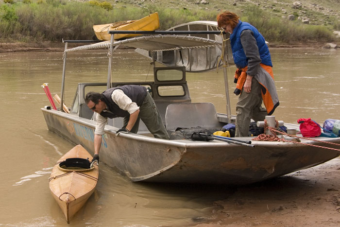
Our haste in the morning paid off, we arrived at the rendezvous point when the jet boat shuttle came up behind us. We loaded our kayaks onto a rack atop the boat and climbed aboard for the return trip to Moab. After loading our kayaks on the rack of the open boat, we criss-crossed the river, picking up four canoeists and heading toward a father and young son with an inflatable kayak. As soon as the boat touched the bank the kid came running towards us and gleefully blurted, "When my cat dies I'm gonna get a ferret!" Everyone onboard was at a complete loss for how to respond to this announcement. We loaded the remaining passengers, bundled up as warmly as possible, and the jet boat roared up the Colorado back toward Moab.
Back to Cape Falcon Kayak